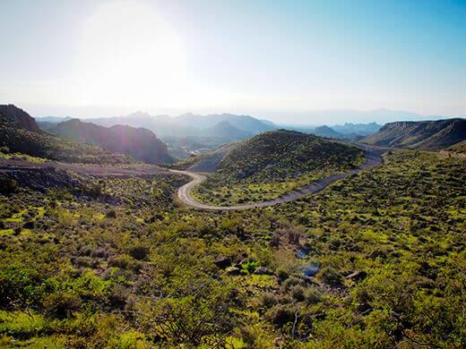
In Route 66 travel lore, the narrow, twisty, two-lane road to or from Oatman, Arizona, is the most intimidating passageway on all of the Mother Road. These 10 miles of steep switchbacks and hairpin turns between Ed’s Camp and Oatman pass through the Black Mountains, and were once the east-west thoroughfare in that part of the country.
For 30 years, cars and trucks traversed the notorious Sitgreaves Pass, with some people even opting to have the locals drive their cars up the steep grades or have them towed over the pass. Early cars (which didn’t have fuel pumps) would sometimes have to drive in reverse to make it up the Gold Hill Grade! After driving forward on the road, I’m amazed that anyone could ever do it backward.
Nowadays cars are a lot more suited for the desolate — but no less adventurous — drive on the now-named Oatman Highway, and a detour off Interstate 40 affords a real Historic Route 66 experience. We were lucky to pass through after three solid weeks of summer monsoons finally let up, and the desert was spectacularly alive and green.
We pulled on to Oatman Highway from Kingman, and the initial stretch was rather deceiving; just a typical back road through the boonies that went straight for what seemed like days. But right after we passed Ed’s Camp, an abandoned relic from the Route 66 days, the road became a twisty-turny thrill that hugged the hillside with no guardrails.
Slight carsickness aside (I have a husband who loves to challenge suggested speed limits), we reached the town of Oatman just before the sun was setting.
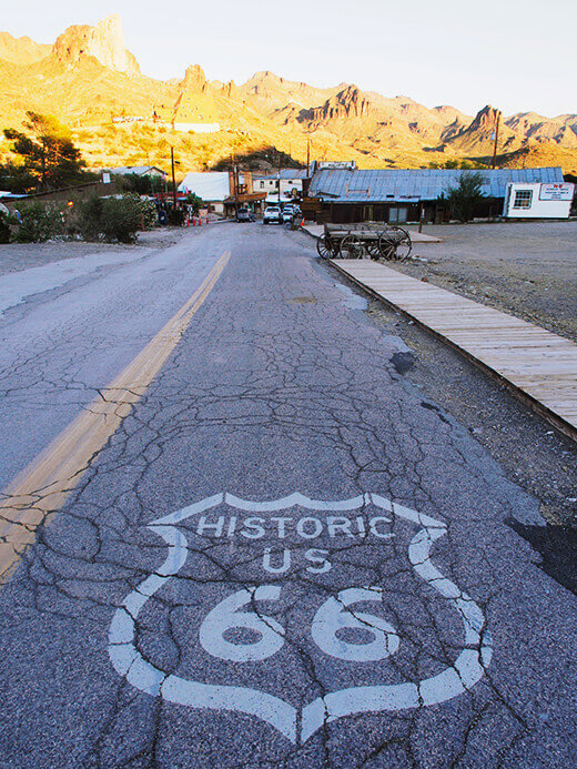
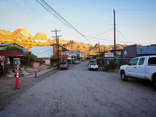
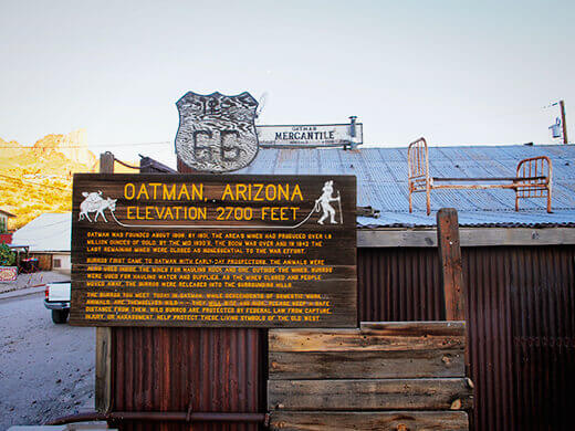
With a population of 128, Oatman is not quite a ghost town but considering that it used to house 10,000 people in its heyday, this former mining town seems to mostly exist as a tourist draw.
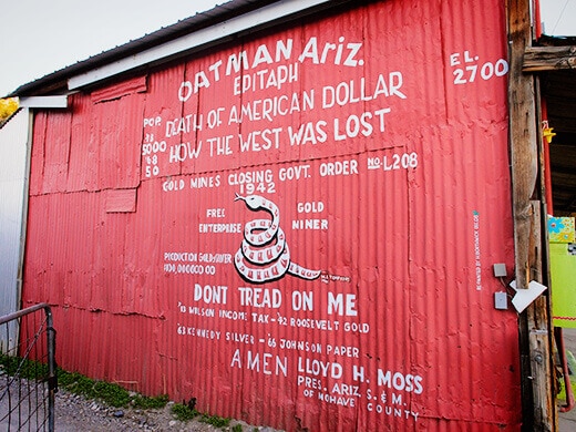
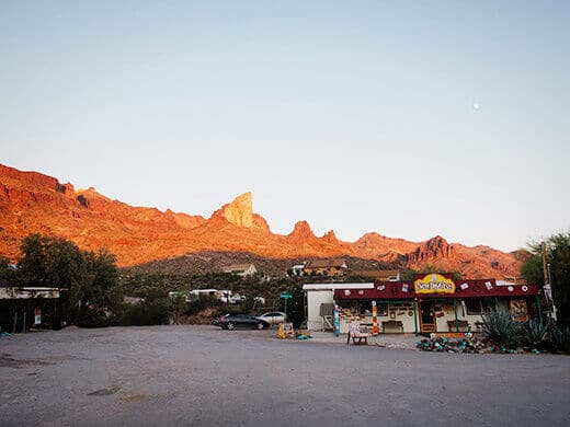
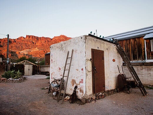
It’s an intriguing glimpse into the Wild West, and when we arrived the businesses had all closed down for the day, feeling like that dusty old town in the movies with a single tumbleweed rolling down the street. On a weekend afternoon we’ve heard that Oatman is quite a lively community that attracts day-trippers from nearby Laughlin, Nevada, as well as road-trippers on Route 66.
The town flourished in 1915 when two prospectors struck $10 million in gold. From the early 1900s to the early 1940s, when mining was at its peak in Oatman, it was the largest producer of gold in Arizona (together with a neighboring town, Goldroad, two miles away).
During the Second World War, the town’s mining operations were shut down as part of the country’s war effort, since other metals besides gold were needed at the time. In 1953, the new — and less torturous — Interstate 40 was built between Kingman, Arizona, and Needles, California, a straighter route that bypassed Oatman completely. By the 1960s, the town was all but abandoned.
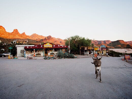
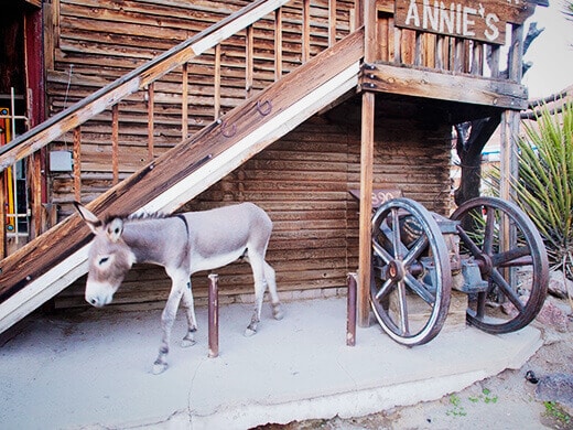
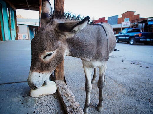
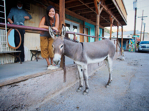
These days, Oatman is a must-stop for Route 66 history buffs. Wild donkeys freely wander the town’s four blocks, begging for “burro chow” from unsuspecting tourists. The donkeys descend from pack animals that had worked in the mines and were left behind when the last settlers left; the current population in town (which we’ve heard can number in the dozens on a good day) is protected by the US Department of the Interior.
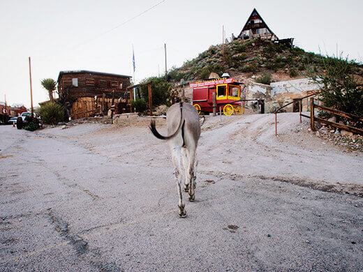
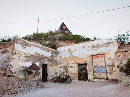
Although a fire in the 1920s burned down many of Oatman’s buildings, it spared the historic Oatman Hotel, built in 1902 and now the oldest two-story adobe structure in Mohave County. The hotel is best known for being a honeymoon stop for Clark Gable and Carole Lombard, who were married in Kingman in 1939, and their honeymoon suite on the second floor still exists.
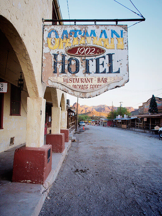
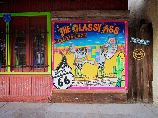
The rest of the street is full of restaurants, saloons and shops, most of them trumpeting their proud Route 66 heritage as well as their classy mascots (ahem, emphasis on ass!), but since there was not a single other person there (seriously, closed means closed in this town), we could only walk past the storefronts.
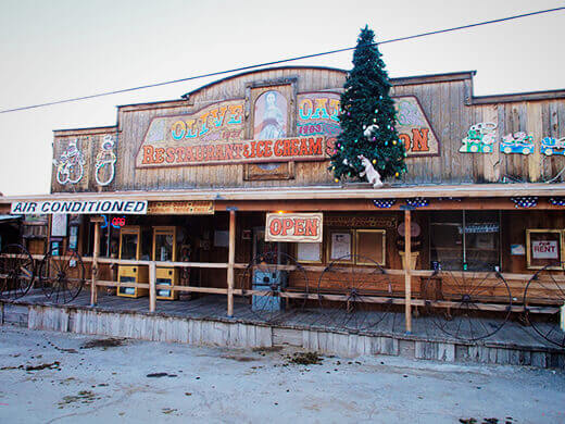
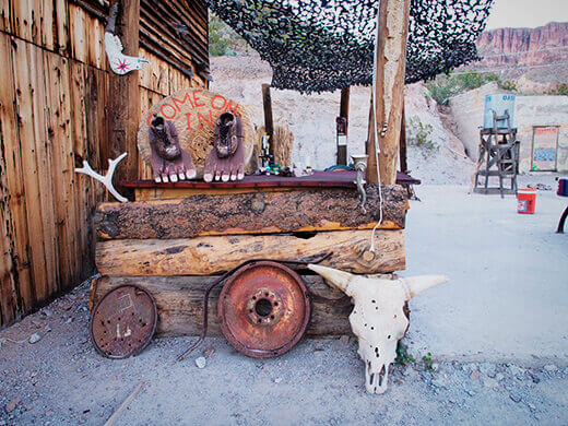
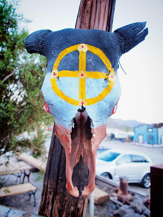
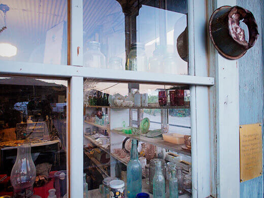
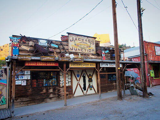
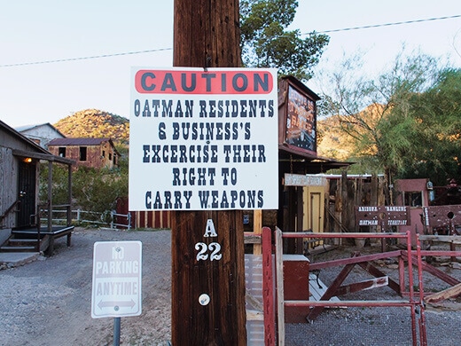
I would love to revisit on a busy and bustling afternoon when herds of burros are roaming the streets while gunfighters are having shootouts!










After reading your Route 66 Oatman Arizona trip, Hope you can come back when th3 stores are open and visit Burro Barn to get acvurate historical information about our village. We had 8 Large hotels, 22 saloons and over 20,000 residents who lived in approximately 8 different suburb sections. Oh and 3,000 mining operations. Next time you’re in Oatman stop in and check out historical photos of what Oatman use to be. The last BOOM TOWN In America
I’d love to revisit Oatman. The historical info in my post was accurate in 2013 when I last visited and wrote this article, but I’d love to see what the town looks like today. 🙂
The roads and scenery can bring us a lot of sense and imagination further.
Hairpin turns to wild burros, all in a town w/ pop. 128. Random Bits From Route 66: Oatman http://t.co/BKCFbesWOU < TY for RT! @route66news
RT @theGardenBetty: Blogged on Garden Betty: Random Bits From Route 66: Oatman http://t.co/fdXP6FpJW6 < TY for RT! @lburbanite
Blogged on Garden Betty: Random Bits From Route 66: Oatman http://t.co/fdXP6FpJW6 < TY for RT! @lburbanite
My husband and I stopped in Oatman on our honeymoon almost 25 years ago and had a great time…thanks for the post as it brought back very fond memories 🙂
That sounds lovely! Did you get to stay in the Oatman Hotel honeymoon suite? 🙂
Getting to this town means taking the most notorious road in all of Route 66. Random Bits From Route 66: Oatman http://t.co/yxq2etKOOv #az
An intriguing glimpse into the Old Wild West of Arizona. Random Bits From Route 66: Oatman http://t.co/PAbFTr0LBJ #route66 #travel
Just getting to this tiny town (pop. 128) is an adventure in itself. Random Bits From Route 66: Oatman http://t.co/WBsC75wQyT #arizona
A must-stop in the Wild West of Arizona for Route 66 history buffs. Random Bits From Route 66: Oatman http://t.co/x1x8X91FRR #roadtrip
RT @theGardenBetty: From hairpin turns to wild burros, all in a town with pop. 128. Random Bits From Route 66: Oatman http://t.co/BKCFbesWO…
RT @theGardenBetty: From hairpin turns to wild burros, all in a town with pop. 128. Random Bits From Route 66: Oatman http://t.co/BKCFbesWO…
From hairpin turns to wild burros, all in a town with pop. 128. Random Bits From Route 66: Oatman http://t.co/BKCFbesWOU #route66 #arizona
Fantastic trip report! I love the burros walking through town.
Very cool! Forgive my naive question, but was the movie Cars based on this town? Or maybe just towns on Route 66 in general…
Geographically, Cars was based on Peach Springs, AZ, but it was really about all the ghost towns that now sit on Route 66. Hackberry’s another one: http://gardenbetty.com/2013/10/random-bits-from-route-66-hackberry/
I actually haven’t seen Cars yet, but after learning some of the history of the area, I’m really curious about it!
RT @theGardenBetty: Blogged on Garden Betty: Random Bits From Route 66: Oatman http://t.co/fdXP6FpJW6
Lizz Yoakum Dukes liked this on Facebook.
Love seeing the West with you, dear girl! Thanks for the road trip!
Random Bits From Route 66: Oatman:
In Route 66 travel lore, the narrow, twisty, two-lane road to or from Oatm… http://t.co/MPrU6hepXZ
Blogged on Garden Betty: Random Bits From Route 66: Oatman http://t.co/fdXP6FpJW6